The Faroe Islands - Vágar
The first reaction I typically got when I said I would be exploring the Faroe Islands for a week was… “and where’s that”? This apparently little-known cluster of 18 islands in the North Atlantic between Iceland and Scotland is actually an autonomous territory of the Kingdom of Denmark (similar to Greenland). I’d glimpsed dramatic photos of its rugged, wind-swept landscapes over the years, and so it had occupied a place on my travel bucket list for some time. Ultimately, when my darling and aged dog Gizmo developed health issues late last year, I wanted to plan my 2023 travel for somewhere where I wouldn’t need to be away from him for longer than 5 or 6 days, and by all accounts, the Faroe Islands fit the bill. Most everything is no more than a 60-90 minute drive away, with an extensive network of sub-sea tunnels to make things even easier.
The airport is not located in the capital city of Tóshavn but instead on an adjacent island, Vágar, making it our entry point into discovering the Faroes. It was also the island I frequented the most, driving out several times to visit and sometimes even re-visit the many beautiful landscapes and charming villages it had to offer.
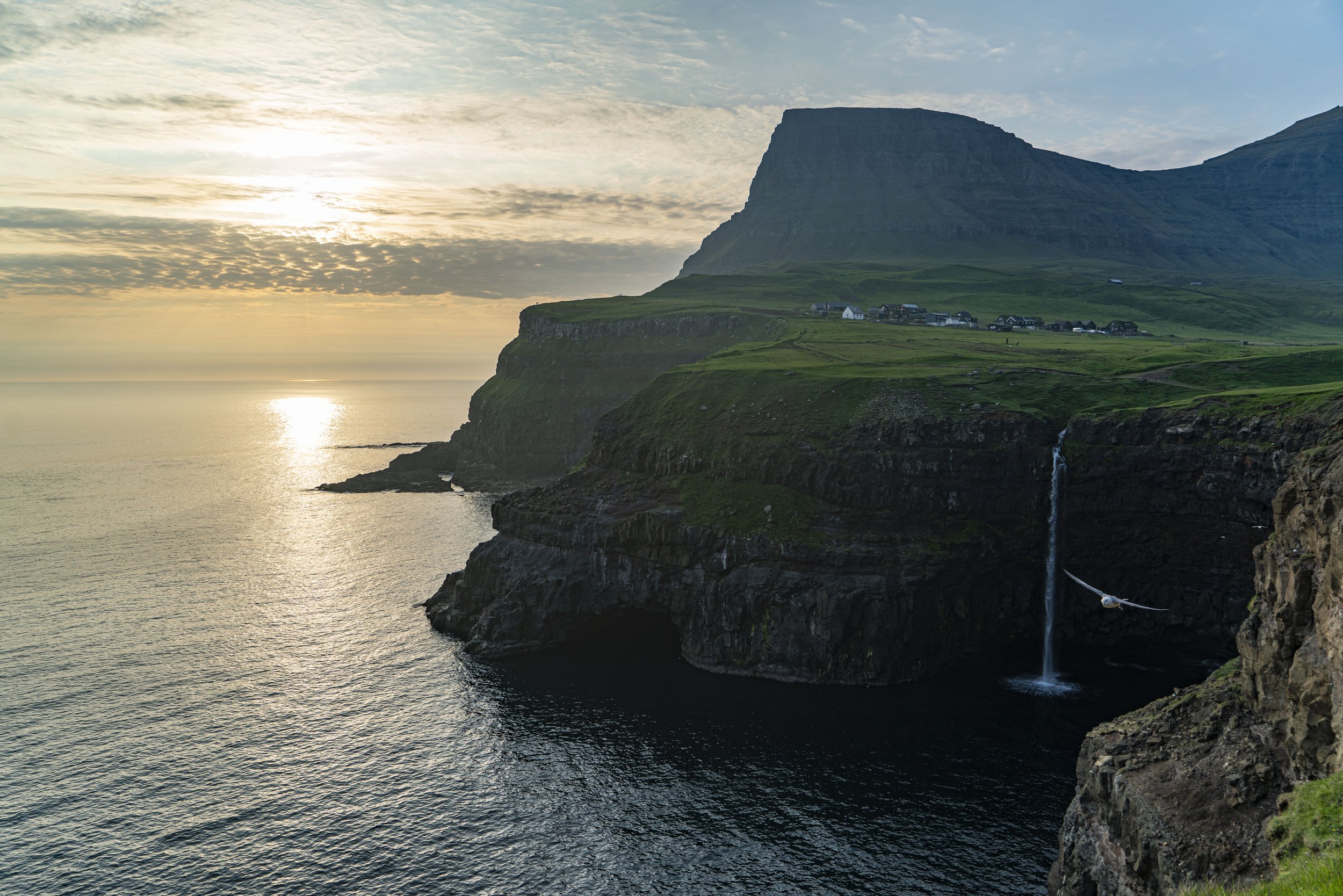
Múlafossur Falls
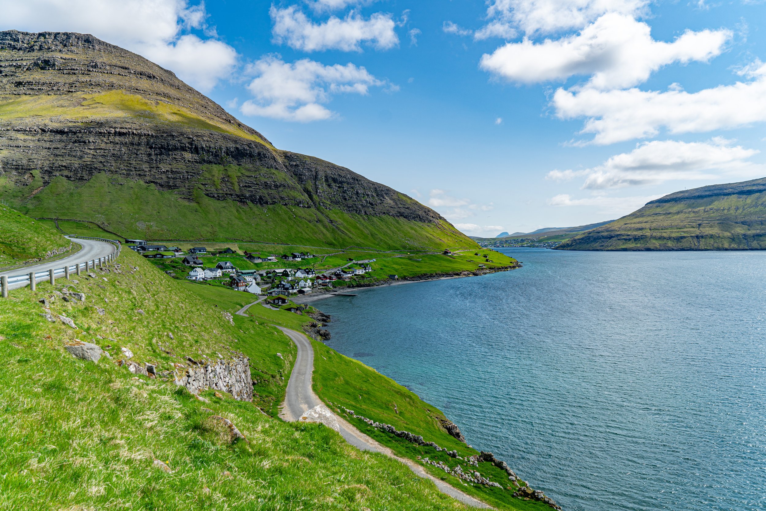
We arrived mid-morning and were eager to get out and explore, so we hopped in our VW rental car and beelined for one of the most famed sights in the country, not even 20 minutes from the airport: Múlafossur Falls. Along the journey, I was happy to discover exceedingly well-maintained roads that wound along the coast line, with plentiful pull-outs affording stunning views of the surrounding isles. Located essentially at the end of the road for the island, a short, dirt trail leads from the road to cliffs overlooking the iconic waterfall tumbling into the ocean, set against a mountain backdrop and the tiny village of Gásadalur.
Our first visit was midday, with the sun somewhat harshly shining down on us. While we were charmed by the bright view and the lone puffin who peeked out to welcome us to the island, I knew that the magic of this place happened at sunset. And so, in a fitting bookend to our time in the Faroe Islands, we returned on our very last night. I left my parents to birdwatch from the main lookout and quickly scampered up the trail to the village to get a view back towards the cliffs now bathed in the ruddy glow of the setting sun. The drive back was punctuated by frequent pull-overs, as we jumped out to photograph the pastel colours painting the sky and the evening mists hovering around distant sea stacks. What an exceptional way to begin and end our journey!
From Sandavágur to Bøur
Sandavágur
The main road in Vágar winds along the coast through a few small towns and villages. The first major settlement on the island when driving from the capital city on the adjacent island of Streymoy is Sandavágur. A charming place, so named for the sandy bay upon which it’s situated, with a distinctive red-roofed church built in 1917. We stopped in for dinner on our last night at Fiskastykkið, a well-known seafood restaurant, where we enjoyed beetroot crepes with bacalao and creme fraiche, a barley salad with cured salmon, cod in a soffritto sauce, and waffles with rhubarb cream for dessert.
Bøur
We visited the village of Bøur, with its 75 inhabitants, on our drive out to Múlafossur Falls. The seaside village features many wooden, turf-roofed homes that are so iconic of the Faroe Islands. We learned that these architectural practices date back to the Viking Age. Because the islands are not forested, they had to build from what was available. Turf also served the purpose of weighing down the roof, as it can be a mite blustery from time to time. These homes were also, quite predominantly, painted black, which is rooted in a history of using tarred wood to better waterproof and retain heat. We wandered through the narrow streets down to the beach, where a group of folk were gamely (insanely?) jumping into the chilly ocean waters.
Lake Sørvágsvatn and Bøsdalafossur Falls
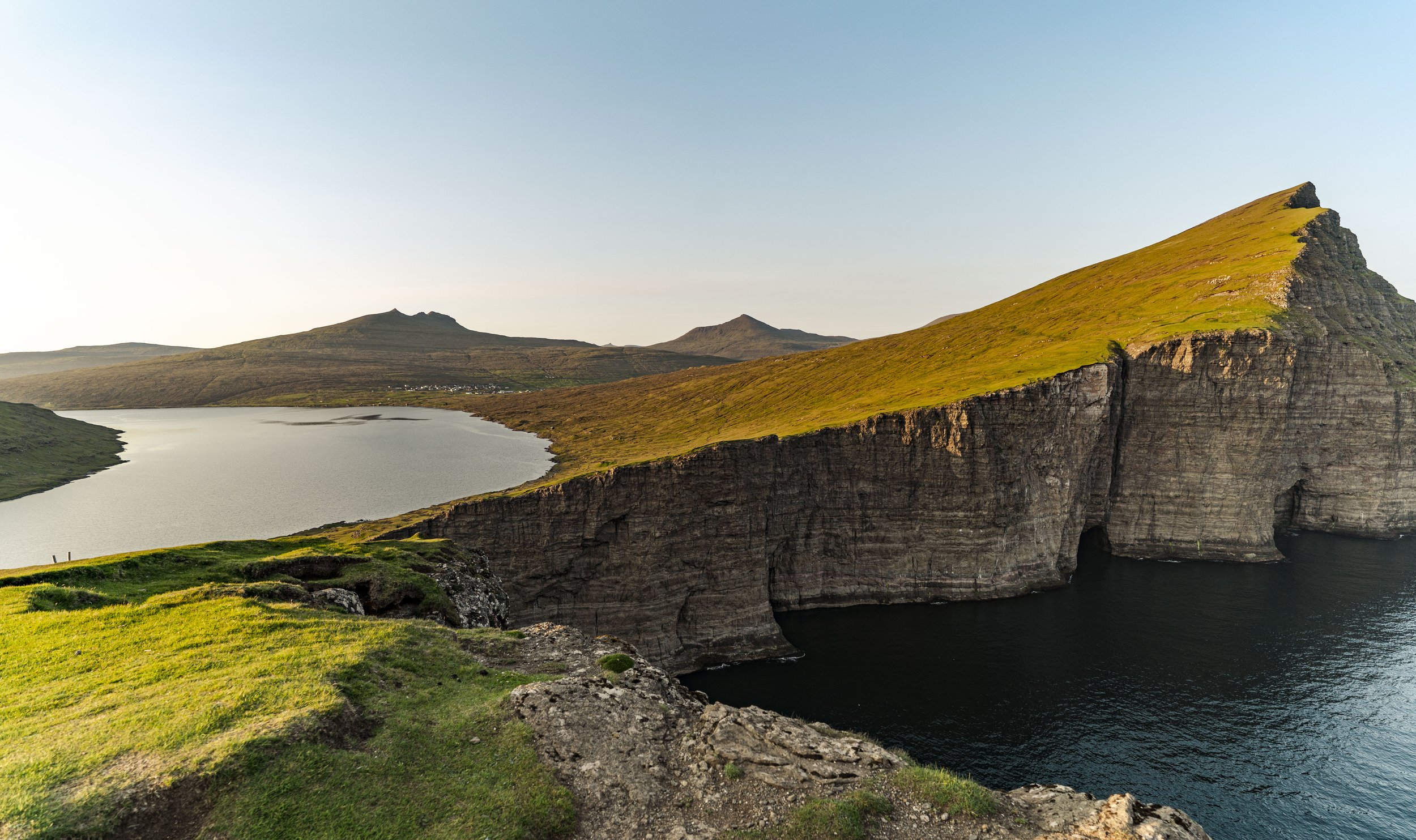
I was excited to take advantage of the exceptionally long days that came from visiting a place so far north in the summertime. At around 8:30 pm, I kicked off an evening hike to Lake Sørvágsvatn, the largest lake in the Faroes. Famed for creating an optical illusion, where at certain angles, it looks like the lake is hanging high over the ocean (when it’s only about 90 feet above sea level). It is a 6.8 km out-and-back trail—a fairly easy, rambling hike along a relatively flat dirt path. I relished the beautiful light, with the sun slowly setting and bathing the landscape in a warm, sepia-toned glow. After about 45 minutes, the trail forks and leads you up a steep climb. Trælanípa, which translates into “slave cliff” or “slave mountain”, was so named because during the Viking age, slaves were supposedly pushed off the 142-meter-high cliff when they were no longer capable of heavy labour.
Putting those rather grisly origins aside, the sweeping view of the lake, cliffs, and islands beyond were truly breathtaking (I mean, yes, I was panting as a result of hiking up a steep hill, but it was stunning). There is a kind of giddiness I get when I near what I’ve been hiking towards…a quickened step as the excitement builds and a breathless laugh upon catching sight of it. I soaked in the views before walking across the grassy cliff and picking my way down the rocks to find Bøsdalafossur Falls, where Lake Sørvágsvatn falls into the ocean.
A few other hikers had congregated in the area to watch the sun go down, but I found myself my own rocky outcropping to perch on and take in the gorgeous view. There are few things more peaceful than sitting on what seems like the edge of the world, listening to the waves lap against the cliffs and watching the sky darken. When I finally made my way back to the car, I kept stopping to marvel at the light. Golden hour in the Faroes is, in fact, several hours, and given that this place is renowned for being perpetually rainy and cloudy, it made sunlight all the more meaningful.


